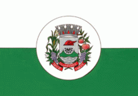
Guaporé (Guaporé)
 |
 |
The immigrant settlement that would eventually give birth to the city began in the early 19th century in the area that is the present-day municipality of Muçum, a smaller number of German cattle herders also established themselves in the area now known as São Valentim do Sul, both towns that used to be part of Guaporé.
In 1892 the colony of Guaporé was established, on area belonging to the cities of Lajeado and Passo Fundo. The colony's manager, Eng. José Montauri de Aguiar Leitão, designated to Eng. Vespasiano Corrêa the task of zoning and dividing the town's area in some 5000 shares of 0.25 to 0.30 km2. Soon after, settlers from the first Italian colonies in the state (mainly Caxias do Sul, Bento Gonçalves and Veranópolis) came to the newly formed town and, in 1896, the colony had already reached 7,000 inhabitants.
In 1897 the Santo Antônio Parish was created, under the Porto Alegre Diocese, being an important step the formation of a city in local culture. By 1900 the population had grown to 13,727. This success led to the formal establishment, on 11 December 1903, of the Municipality of Guaporé, with Eng. Vespasiano Rodrigues Corrêa as the first mayor, inaugurated on 1 January 1904.
By 1910, Guaporé had around 30,000 inhabitants, even more than today, with 1,020 living in the town center, which had over 170 buildings, a town square, telegraph, post office and church. Agriculture was the most important economical activity, the main crops being rice, beans, corn, soy, orange and vines. Furthermore, 82 businesses and a few industries were established by the time, producing aguardente, wine, cheese and lard.
Through the years, several districts emancipated from Guaporé, significantly reducing the city's area and population. Today, several municipalities make up what was once Guaporé, the largest being Casca (emancipated in 1954), Muçum (1959), Serafina Corrêa (1960) and Dois Lajeados (1987), among many others.
Map - Guaporé (Guaporé)
Map
Country - Brazil
Currency / Language
| ISO | Currency | Symbol | Significant figures |
|---|---|---|---|
| BRL | Brazilian real | R$ | 2 |
| ISO | Language |
|---|---|
| EN | English language |
| FR | French language |
| PT | Portuguese language |
| ES | Spanish language |


